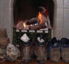
Sunday, 15 April 2007

Reflections

Having worked hard in preparation for this walk, there was every chance that we could have been disappointed by it; especially with one of the party having walked Wainwright's incredible Coast to Coast walk a couple of years previously. However, this was not the case at all.

The walk was a lot tougher than we had expected, but that was actually welcome. We think that it's fair to say that 4 days is not enough time in which to do the walk comfortably and we would have liked to have had some more time to explore the villages and the remains that we walked past. Indeed, the walk was full of historical interest and the views were often incredible, particularly around Housesteads and coming into Bowness.

It may be worth suggesting that for all the non-purists out there, the first day could be left out without too much lost. It is hard going over tarmac and not very attractive. There is some interesting architecture but not enough to warrant 12 miles of tarmac stomping. That said, we are glad that we did it all, but there would be no harm done in starting at Heddon-On-The-Wall instead.

We found the whole experience very enjoyable; the trail was, on the whole, brilliantly sign-posted and we had to do very little navigation of our own. The accommodation that we used was fantastic and the public transport system seemed very good indeed - there is a dedicated bus service for the trail which starts from early April. What was particularly rewarding was the friendliness of other walkers; everyone had time to stop and chat and to give recommendations of places to stay or eat.

So that was Hadrian's Wall Path - a justly popular trail through beautiful countryside, and a worthy start to our BlogWalking.

The Walk Itself: 13th April 2007: Day 4½

Cramming our holidays brim-full, we had various commitments to meet in between Day 4 and Day 4½ (not least the Wainwrights - http://blogwalkers-wainwrights.blogspot.com and the preparations for the Yorkshire Three Peaks Challenge - http://blogwalkers-yorkshirethreepeaks.blogspot.com). Nonetheless, we were fully recovered when we returned to Carlisle for the final stint.

Starting where we'd left the path at Eden Bridge at lunchtime, we continued our trek Westwards. As at Newcastle, where the trail passes through a city it passes through some less pleasant areas, but out of Carlisle and along the river Eden was very nice walking. Again, the sun was out for us:


Despite the previous day's trip up Scafell Pike, our legs were much fresher and we kept a steady 3 mph. Departing from the Eden, the path passes through some lovely villages - Grinsdale, Beaumont and Burgh-by-Sands.

Burgh (pronounced "Bruff") bears mention for keeping us hungry... We'd failed to bring a lunch, confident of finding something on the way, but by Burgh there had been nothing and our stomachs were sorrowed to see the Greyhound Inn closed and the Post Office (marked on the Harvey map) non-existant or impossibly hidden.

We drew lots to see whose arm would be first for the pot, but fate stepped in to help us as we toiled along the arrow-straight road from Burgh to Drumburgh:


Two small boys leapt from a disused shack and offered to sell us crisps. We restrained ourselves from being unreasonable (what, no sandwiches?), made the purchase and headed on. As far as the self-service canteen at Grange Farm where we supplemented the crisps with cake, ice-cream and chocolate. Day 4½ was not shaping up to be a healthy day.

After Drumburgh the miles fell away under enthusiastic feet and at each successive village we were pleasantly surprised at the time we'd taken. Glasson was pleasant but we resisted the draw of the Highland Laddie and marched on to Port Carlisle where we were badly bored by a well-meaning local. But we didn't mind as the views along the Solway coast were spectacular:


The finish post of Bowness-in-Solway came into sight as the sun began to set:


- and we ended our walk across the country in the lovely village of Bowness. Here they do mark the end of the trail - with a nice surprise which you will find out for yourself.

Finally, dinner in the homely King's Arms with the Fellrunner who came to retrieve us. Good food and Jenning's ale, and somehow the landlord guessed we were Hadrian's Wallers and gave us certificates without us even asking...
Distance: 15 miles on Day 4½ and 86 in total.

The Walk Itself: 5th April 2007: Day 4

We had a lengthy sleep and a good breakfast and felt better for walking a sensible distance on Day 3. But the enlarged foot of one BlogWalker and olive-sized blisters covering the small toes of the other suggested that walking would still be a painful experience.

Doing without a packed lunch lightened our packs a little, but the planned 26 miles was firmly out of the question. After another council-of-war, we decided that 86 miles in four days was too ambitious and we'd enjoy Day 4 better if we split it into two.

So it was decided, we would walk to Carlisle in the morning (12 miles), and return later in the Easter break to finish the remaining 14 miles one afternoon. 4½ days for 86 miles still being respectable - even with the bus interlude... We set off reinvigorated into a misty morning:


Pleasant cross-country walk past farms, a heron and a donkey, and the day warmed up as we continued on. Our legs were soon aching again and we took advantage of the reduced distance to stop at Crosby Lodge hotel for tea and sandwiches in their beautiful garden in the sun:


Highly recommended for scenery and sandwich fillings.

Continuing our relaxed pace and our share of the luck, we got into Carlisle just in time for the four o'clock train back to Whitehaven. We staggered up the hill to Glenfield and had relaxing baths while a slap-up evening meal was prepared for us.

A thoroughly enjoyable day; missing the fantastic scenery of Day 3, but without the up-ing and down-ing that fantastic scenery usually entails. We did come across one puzzle - a message scratched into the sand by some Path walker:


- which seems to say "POD". A message from aliens? Leave a comment if you have any clues.
Distance: 12 miles (all by foot).

The Walk Itself: 4th April 2007: Day 3

Awoke to feel unexpectedly achy; the long miles the day before, lack of bath and a reasonably late night meant that our bodies hadn't fully recuperated. However, full on a massive breakfast and cheered on by the sun, we set off back up to the Roman fort at Housesteads where we had left off the day before.


Despite it being sunny, the wind was icy cold and we were soon wearing everything that we had with us. For the first 6 miles it was up and down over a number of hills, leaving us exhausted. Adding aching feet to the combination of weary limbs and heavy packs, we took a full three hours to walk the first three miles - but the views were fantastic:


However, as the day wore on so did the blisters and the swollen feet and the planned 19 miles (on top of the 41 miles already walked) started to take on an unpleasant aspect. Tiredness stops increased in frequency, and we had a lengthy lie down in the sun at Cawfields quarry - in the company of numerous frogs and a duck which had the lake to himself:


We increased the pace as far as the Roman Army Museum, but knees, toes and spirits were feeling bruised. After a soul-searching discussion which centred on the key points that: a) this was meant to be a holiday and b) holidays are meant to be enjoyable, we decided an alternative plan was necessary.


Our eagle-eyed team spotted a bus timetable and the plan was laid. We would walk the next three miles to Gilsland and bus the rest of the way - clocking up 12 walking miles and seven bus miles. As Bill Bryson says, the secret of a long-distance walk is knowing when to stop.


The thought of motorised transport cheered us considerably and we did the next three miles at a respectable 3 mph, pausing only to snap Thirlwall Castle:


At Gilsland the luck continued, with a (no-charge) cash machine and ice-cream freezer in the post-office and a sunny sit-down waiting for the bus. Disappointingly, the bus didn't go direct to the Centurion Inn, so we alighted at Brampton and got a taxi the rest of the way.


At the Centurion we sat quietly while our limbs calmed themselves and then ate an excellent dinner in the company of the pub's cat and washed down the food with Timothy Taylor's Landlord on tap.

Distance: 19 miles (seven by bus...)

The Walk Itself: 3rd April 2007: Day 2

We awoke with a remarkable lack of aches and pains and had a very hearty breakfast, settled the bill and headed out with no packed lunch...The weight saving was a blessing but it left us prey for torture from the off.

We had more weather than yesterday - grey and drizzly for much of the morning with a fairly consistent wind. To buy us luck, we gave the bananas, which the Ironsign owner had freely given, to a pair of young lads who were camping the wall and looked particularly hungry and forlorn as the first shop they had passed was shut and they had no food, except for a strange looking cake.


We progressed at a fine pace, still both feeling strong and free of pain. It was far better walking, with nice scenery and countryside under foot. The first crushing blow came when we arrived at the St Oswalds-On-The-Wall tea shop and found it CLOSED! Dreams of sitting and warming our bones to the tune of tea and cake were dashed.

Disheartened, the walk to Chollerford became a slog with us failing to leave the route to inspect a section of the wall, owing to a lack of interest. Thankfully, the tea shop at Chollerford was open and excellent and we refreshed and warmed ourselves before tackling the final slog up to Houseteads. There was some more wall-poking opportunities and, at times, we found ourselves actually on the wall, without meaning to!

After 20 miles, with 3 to go, we were very tired and had aching legs; there were cows which needed to be chased away from a wall stile and we struggled to appreciate the beautiful scenery heading up to the Roman Fort (will return to take it in more!). However, we finally made it to Beggar Bog farm house which was absolutely fantastic - friendly with beautiful views.


The landlady had organised a taxi to The Milecastle Inn where we had a fine meal, nearly spent the taxi money and headed back for a peaceful night's sleep.
Total distance: 24 miles (23 on the path + 1 to Beggar Bog)

The Walk Itself: 2nd April 2007: Day 1

Everything had gone suspiciously according to plan. We arrived at Glenfield Guest House the night before and were up at 5.20 in the morning with a taxi booked to take us to Whitehaven Train station at 6.10. The train was waiting for us when we arrived and we were soon on our way to Carlisle. We had a nice cup of tea and danish in a Victorian tea-room at Carlisle train station and then caught the 8.30 train to Newcastle-Upon-Tyne. There were beautiful views from the train of wonderful countryside and newly born lambs.

After completing tasks revolving around renewing passports, we bought some breakfast baps and caught the Metro to Wallsend. We began the walk at 11.20.

It was a disappointment to learn that there was nothing to technically mark the start and our amusing plan of pretending to add our names to the list of centurion wall-builders on the official stone was thwarted by it being locked behind an enormous fence.

A long walk through Newcastle began the trail and there were some decidedly dodgy areas which had to be walked through. However, the two dodgy parts were interrupted by a lovely section along the Tyne where we saw 7 bridges and St Peter's Marina which were all lovely. There were also some very interesting sculptures along the way.


It became much more pleasant when we reached Tyne Riverside Contry Park where there was plenty of seating for weary walkers, as well as toilets and an ice-cream van - yay. We sat and had our lunch and rested our tired legs. It was then cross-country and up-hill to Heddon-On-The-Wall where we stopped for a drink at The Swan; this was also our first opportunity to have a poke at the wall as there was a good section of it still standing.

We then carried on across country to Ironside where we had a fantastic meal, a warm bath and a deep sleep in a warm bed.
Distance: 17 miles

Sunday, 18 March 2007

Dartmoor: 17 March 2007

We awoke to disappointing weather after a week of glorious sunshine. However, undaunted, we set off to Shipley Bridge with a mind to complete a 10.5 mile walk across Dartmoor.

Although Mr BlogWalker had walked in Dartmoor before, this was the first proper Dartmoor adventure for me, and I was very excited. We were joined by our veteran BlogWalker who we had jouneyed down to Plymouth to see for Mothering Sunday (and for her brilliant potatoes).

So, we parked up at Shipley Bridge with most of Devon and set off up a stony path and onto the 'Moors'. We followed a wall for sometime before escaping onto the wilderness. The track took us up to Spurrell's Cross and onto the Tramway which had previously hauled men and materials in trucks to the Red Lake China clay works.


It was cold but bearable on the moors and, for me, it was brilliant to see so much history in such a wild and desolate place.

We followed the tramway alongside boundary stones which marked the line between the parishes of Ugborough and Harford. This led us up to Three Barrows, from where there were fantastic views, and then to the ruins of miners' houses and the disused pit of Leftlake Mires where we had a heartly lunch.

There was then a long stretch following the tramway before we headed off past many ruined buildings. We took a detour to Petre's Cross where we met a man looking concerned about some expected school children. Petre's Cross had lost its arms when peatcutters had taken them to use as a lintel for a fireplace in 1847.

Having admired the cross, we took a track onto a grass tramway which made for a beautiful and easy-going path back down to Shipley Bridge.

In all, a beautiful walk with a lot to see.

The walk was courtesy of Country Walking's Down Your Way series (March 2005: Follow That Tram!).

Sunday, 4 March 2007

The Fox Way: Day 2 - 4th March 2007

Rained all day. Not quite all day - for the last ten minutes the skies cleared a little, but for the preceeding six hours and twenty minutes, it rained incessantly. Sometimes heavily and sometimes not quite so heavily, it made the second day of the Fox Way something of a trudge.


We covered the remaining four 'links' from Ripley to Godalming without our international accompaniment, but with our fell-running pacemaker keeping us on our toes when morale dipped. Which was not too often, in fairness - for three soaking wet people, two of them aching considerably from the start, there was very little moaning and we got the job done.


From Ripley through to Shere we covered some familiar ground, passing the Surrey Hills brewery, crossing the North Downs Way and carrying on to Silent Pool. The last time we'd seen it (in the height of summer) there was no water at all, but now (possibly owing to the rain) it was full, in all its "eerie calm" glory (see http://www.mostparanormal.co.uk/html/silent_pool_surrey.html for some nonsense on the origin of the name).


Shere to Bramley was new to us, and would no doubt have been a very pleasant journey in more hospitable weather. Shere looks to be a village with some character, and we will certainly return to spend a little more time nosing around the streets and pubs. The route skirts underneath Blackheath Forest, and from this point you can allegedly see Guildford Cathedral:


- although we could not. Through this section we also got reacquainted with our old friend: ankle-deep oozing mud. This attempt to capture it in motion was not wholly successful, as the camera coped less well with the endless rain than its masters:


The final leg from Bramley to Godalming was a bit of a slog - with tired legs, soaked through and feeling quite cold, every step became an ordeal. Even the cajoles, entreaties and barkings of our Iron Man (who seemed unaffected by the day) couldn't rouse us, and we finished the last couple of miles with dragging feet.


Safely at home in the warm and dry, with a steaming bath and an Indian banquet to look forward to, the cold and the aching and the wet seem very far away.


All in all, an enjoyable and well-thought-out route (http://www.thefoxway.com/). Easily accessible with public transport, and with plenty to keep you interested. Possibly approach it over three days though... And at a drier time of year.
19 miles in 6.5 hours - not bad.

Saturday, 3 March 2007

The Fox Way: Day 1 - 3rd March 2007

Well, we had been planning this day for weeks, after we had decided that we needed to get in some multi-day walking trips. We had bought the Fox Way guide, dug out the map and made the lunch. All we had to do was walk 20 miles from Godalming to Ripley. Hmm.

We were to be joined by our fell-running pacer and 2 friends who are also keen walkers. One of them had completed the Camino de Santiago and both of them are incredibly fit. They arrived at 9.00 and we were parked at Godalming Station and on our way by 9.45. The day began bright and sunny and we were all in good spirits.

The path to Wanborough station was incredibly muddy and we were regularly wading through watery mud up to our ankles. However, despite warnings to turn back by other walkers, we perservered and made our way to the station via the beautiful village of Puttenham.

We then had to make our way through Merrist Wood and the golf course to Worplesdon station. The path became even muddier and one of our team did a fantastic slide through the mud and only just stopped herself from a certain drowning by sacrificng her dignity and sitting on her bum. Our spirits dipped a little when it began to rain but, thankfully, it was only a short shower. They were raised again by an exciting sighting of two deer. In fact it was a very wildlife friendly walk: we saw squirrels, rabbits, Aberdeen Angus cows, normal cows and some pigs that apparantly bit!


We stopped at Merrist Wood college and perched on a wall to eat a hearty lunch and share out a very welcome flask of tea. We were entertained by a mad woman asking where the golf course was and was horrifed when we suggested that she walked to it (it was about 2 minutes' away). We also saw a man walking around with a falcon attached to his glove which was slightly unexpected.

It was then a much more pleasant walk back to Ripley, following the River Wey. Although we were all quite tired, we couldn't help but appreciate the warmth of the sun on our back as it sank.

We arrived home tired but pleased with ourselves. We had done the 20 miles in 7 and a half hours, which included a long lunch and very tricky walking conditions.
Tomorrow: only 19 miles. Easy.

Sunday, 4 February 2007

River Wey Navigation - 04 February 2007

Distance. There's no escaping it on a long distance walk, so we decided to up our mileage for today's stroll. Another home-made route, we started at Ripley and headed to Guildford on the River Wey Navigation - planning to return via the North Downs Way to clock up 20 miles.

A long walk for a winter's day, we made an early start to make sure we'd be getting home in daylight. Very cold and crisp, the route down to Guildford was cloaked in mist, so the views along the Wey Navigation lacked their usual colour.


We lunched in the park at Shalford, replenishing blood sugar levels with tea and Mini-Eggs. Then on along the North Downs Way past St. Martha's Hill and Newland's Corner. By now the mist had cleared and the sun was out, but we only kept warm from our brisk pace.


The return leg to Ripley branched away from the North Downs and took us along country roads through East Clandon. The BlogWalkers were tired but our resident fell-runner had no aching legs or weary feet. We managed 20 miles in about seven hours (obviously, we failed to accurately note the time of start or end), which we were happy with.

Not without incident, the walk had seen one team member savaged by a vicious dog and left gasping for life; another required first-aid surgery on their trousers after an unprovoked attack by a tree root; and we discovered the magical site of Surrey Hills brewery - makers of the very excellent Shere Drop.

Other plans will keep us from weekend walking now until March. Then we're planning to walk the Fox Way (39 miles over two days) to get back into the swing of things. Before then, most of the team will be in the Lakes, recording their progress on BlogWalkers: The Wainwrights.

Wednesday, 31 January 2007

Greensand Way - 28th January 2007

With one member of BlogWalkers feeling under the weather there was a decision made to do a slightly shorter walk this weekend. We were joined by a veteran BlogWalker, who is also mum to Mr BlogWalker; the reason for the visit was because it was Mr BlogWalker's birthday weekend - 29 on the 29th!


The day was lovely and sunny with just a bit of a chilly breeze in the air. We parked near Thursley (a beautiful village) and followed the Greensand Way all the way down to Brook. We then headed north and stopped in a lovely pub just north of Witley where we filled up on tasty sandwiches, well-deserved Spitfire and a St. Clements for the older element of the group.


We then headed back along a made-up route along tracks and fields until we reached the car.

We walked approximately 7-8 miles but unfortunately we have no idea how long it took us as, once again, nobody thought to take a watch!

Sunday, 21 January 2007

The Monarch's Way - 21st January 2007

Concerned about their speed, the BlogWalkers drafted in some support for this one: a fell-runner who completed all 214 Wainwrights in 11 months and is currently training for the Bob Graham round:


Another homemade route, we started at Duncton Hill near the South Downs Way and walked in an exaggerated figure-of-eight, encompassing Bignor Hill, Houghton Forest, the entertainingly-named Gumber Farm and Bishop's Ring Chalk Pit.

We spent much of our time on the Monarch's Way - a 614 mile route tracing the flight of Charles II and encompassing some beautiful scenery:

The day was splendid - bright and sunny, but crisp and cold. We covered fifteen miles in about five hours (the BlogWalkers began well, but ended up slowing down their support), and were tired but pleased with themselves on the journey home.

The Cotswold Way - 13th January 2007

We went to the Cotswolds for our second anniversary and had a fantastic time in Plough Cottage just outside of Painswick (courtesy of Rural Retreats www.ruralretreats.co.uk/).

Having settled in on the Friday night we woke up bright and early on the Saturday eager to explore some of the countryside which was on our doorstep.

We devised our own route of approximately 12 miles which allowed us to walk right from our door step, through Painswick and onto the Cotswold Way. We left the Cotswold way and went past Saltridge Hill, got a bit confused in Lord's Wood and then followed the river by Damsell's Mill home.


Although the weather looked threatening, we were incredibly lucky to stay dry. Our navigational skills were put to the test and we had to use the map, a compass and the GPS in order to find our way. In all, with all the difficulties, the walk took us about 5 hours although we unfortunately didn't pay much attention to the time.

We celebrated by going to the Falcon Inn in Painswick and having a cracking meal.

The following day we decided to have an easier day and walked approximately five miles in all. Oh, and we accidentally ended up at The Woolpack in Slad and ate an enormous roast dinner, washed down with a pint of Uley Bitter.


Windsor Great Park - 7th January 2007

Whether we forgot to take the camera, or forgot to take any pictures no-one can now remember, so we've got a library picture of the Long Walk through Windsor Great Park:


Although we're keen walkers, this was the first walk of the year where we were actively thinking about preparations for Hadrian's Wall - namely, distance and speed.

The route was one of the Down Your Way walks from Country Walking magazine ("Royal Ramble", September 2003). A distance of 9.5 miles, we did it in cold, overcast but dry weather, and clocked in at 3 hours.

A very pleasant circular stroll starting at Datchet, encompassing part of the Thames Path and Windsor Great Park (as mentioned by the marvellous Bill Bryson - http://www.amazon.co.uk/Notes-Small-Island-Bill-Bryson/dp/0552996009), finishing with views of Eton and Victoria Bridge.

Coped remarkably well without tired limbs; a promising start to the preparations.

How it all began - 31st December 2006

Sitting around a dinner table, full and not entirely unaffected by alcohol, we began to discuss our plans for the future. Being New Year's Eve we quickly got on to the topic of New Year Resolutions.

From The Three Peaks Challenge (to be the topic of another blog) to cutting down on chocolate we discussed all sorts. However, the one that we were most likely to succeed in was to complete the Hadrian's Wall Path.

Being more stubborn than two-dozen mules we have put into practice all the resolutions and we are now preparing to walk the Hadrian's Wall Path over Easter.

Mental note to self: Next year the resolutions should be to get more sleep and eat more chocolate.

Introduction

Hello, we're the BlogWalkers:


After a few weeks fiddling with timetables, we've booked our accommodation and started our preparatory walks for Hadrian's Wall Path (http://www.nationaltrail.co.uk/hadrianswall).

The National Trail is 84 miles long, starting at Wallsend near Newcastle and finishing at Bowness-on-Solway. We've decided to tackle it in four days over Easter, and our finalised timetable looks like this:

Day 0 - head up North from Surrey, staying in our favourite bed and breakfast in the Lake District, Glenfield Guest House in Whitehaven (http://www.glenfield-whitehaven.co.uk).

Day 1 - get on the train from Whitehaven to Newcastle, the tram from Newcastle to Wallsend and then walk to a hotel just West of Heddon-on-the-Wall (http://www.ironsign.co.uk). Distance: 17 miles.

Day 2 - walk and keep walking to Housesteads and collapse at Beggar Bog B&B (http://www.beggarbog.com). Distance: 22 miles.

Day 3 - more of the same, Westwards to to Walton and a stay at The Centurion Inn (http://www.centurion-hadrianswall.com). Distance: 19 miles.

Day 4 - last day. From Walton to Bowness, and a well-earned return to Glenfield's hospitality. Distance: 26 miles.

We've just realised, typing this up, that we got our distances confused and day 3 should have been the mammoth 26-miler, with a more relaxing 19 on the final day. Still, we're all booked up now and we'll just have to lace up and live with it.